
The UFO Sightings Map plots over 90,000 reports of UFO sightings since 1905. The map uses data from the National UFO Reporting Center.
UFO sightings are shown on the map using scaled map markers. The size of each marker relates to the number of eye witnesses. If you select a marker on the map you can actually read the witness reports. Many of the reports are accompanied by videos or pictures recorded by the eye witnesses.

QuantBait has created an animated map of all United States UFO sightings from 1933-2010. The UFO Sightings and Visualizations map also uses data submitted to the National UFO Reporting Center.
The map uses CartoDB's Torque library to animate through the decades of UFO sightings. The map reveals a clear trend of increasing numbers of close encounters through time. I'm not sure if this is the result of more and more alien invasions or increasing air traffic in the United States.
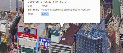
For a number of years UFO Stalker has been using the Google Maps API to show the locations of the latest UFO reports to MUFON (the Mutual UFO Network).
The map includes a number of filters, which allow you to filter the aliens on the map by date and the type of close encounter. If you click on a map marker you can read the event details of the reported sighting. It is also possible to search the map by location and date and view the latest reports in list format.
No comments:
Post a Comment